

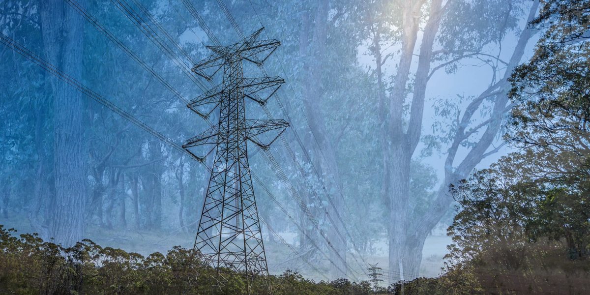
Building huge infrastructure always has a huge cost. Financially and environmentally.
The environmental impact statement (EIS) for the New England Renewable Energy Zone (REZ) transmission line was released this week. This complex document spells out in detail the impact of the vast infrastructure project on both the natural and human environment, with detailed sections on everything from agriculture to Aboriginal heritage, traffic, the economy, and water.
The most detailed information is on the natural environment. The EIS for the New England REZ infrastructure project shows the planned transmission line will clear 3,203 hectares of native vegetation, including critically endangered grassy woodland, and harm 15 plants, animals, and ecological communities at risk of “serious and irreversible” damage.
The area to be cleared is slightly larger than the city of Armidale. NSW law allows it.
Damage at every point of the transmission line
When one reads through the confronting list of intended environmental devastation, an obvious question comes to mind: why can’t the transmission line simply go around?
“The trouble with a linear infrastructure like a power line is that there’s only so many zigs and zags that you can do,” said Stringybark Ecological principal consultant David Carr.
“The engineers just want it to go from point A to point B in as straight a line as possible.”
Mr Carr’s local firm knows the terrain well: they did assessment work on the Winterbourne wind farm. He is also part of a local biodiversity reference group that has been advising EnergyCo for three years.
“So they’re trying to balance. They’re avoiding national parks. They’re avoiding critical infrastructure where they can. They’re avoiding fire impacts. They’re trying to avoid hostile landholders.”
“They’re trying to sort of please everybody with a route. And at some point, they’re going to go through some of this vegetation that they can’t avoid.”
The complex challenge of building massive new infrastructure is made harder by protests from people who don’t want it in their backyard. But EnergyCo denies that the shift of the original route away from Tamworth was about reducing the human impact at a cost of greater environmental impact.
“If we go somewhere where there’s no vegetation impact or no biodiversity impact, we’re almost by definition going to have a greater human impact,” said EnergyCo Deputy Project Director Julian Watson.
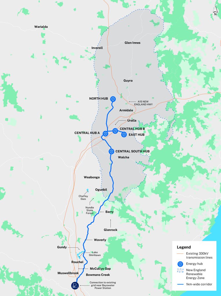
“There’s no way to get from the New England tablelands down to Muswellbrook without coming across some vegetated area, no matter what route or corridor we select.”
The damage, from south to north
In short, there is no way to build the transmission line without some environmental damage. Here is some of what they think will suffer “Serious and Irreversible Impacts” (SAIIs), and other significant impact, from south to north.
The 15 ‘SAII’s
- New England Peppermint grassy woodland: 146.75 hectares (50.07 surveyed, 96.68 mapped on land not entered)
- Box-gum woodland: 1,215.62 hectares
- Small-fruited mountain gum: 2,294 individuals
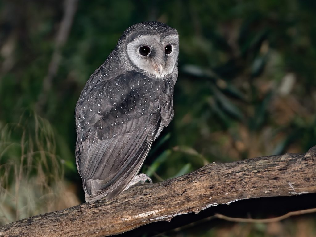
- Sooty owl: 11.95 hectares of potential breeding habitat
- Tusked frog, Nandewar and New England Tableland population: 406.99 hectares
- Euphrasia arguta: 30.84 hectares
- Yellow loosestrife: 0.93 hectares
- Pterostylis riparia: 57.57 hectares
- Scrub turpentine: 217 individuals
- Large-eared pied bat: 0.18 hectares of potential breeding habitat
- Long sunskink: 529.79 hectares
- Large bent-winged bat: 0.1 hectares of potential breeding habitat
- Stuttering frog: 100.36 hectares
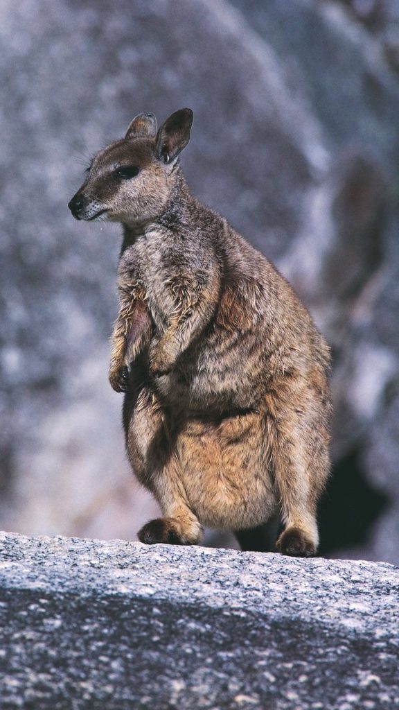
- Brush-tailed rock-wallaby: 199.56 hectares
- Eastern cave bat: 0.18 hectares of potential breeding habitat
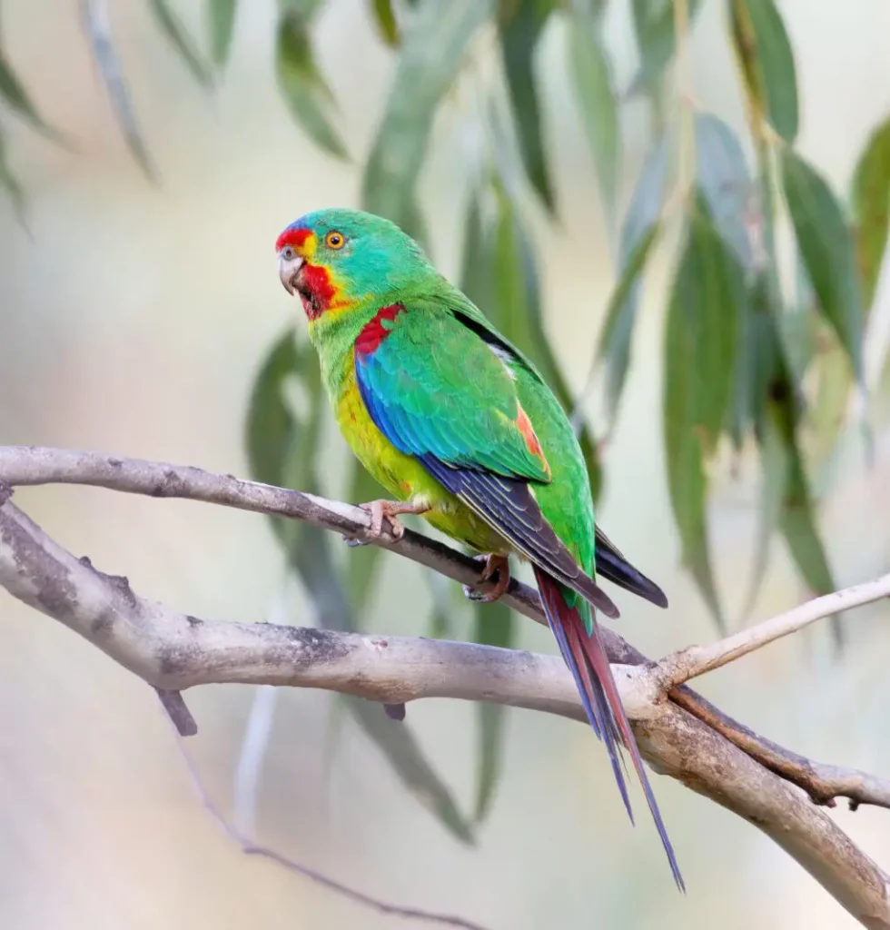
In the Upper Hunter, the transmission line crosses the Lake Glenbawn Wildlife Refuge, affecting about 75.45 hectares of native vegetation. Near Muswellbrook in July 2025, surveyors found about 20 swift parrots feeding on flowering grey box. Their numbers fell from about 2,000 in 2010 to about 300 in 2020, and the migratory species that travels between Tasmania and the Hunter is critically endangered. The transmission line would clear 518.72 hectares of its foraging habitat.
From there the transmission line climbs the Liverpool Range through forest country.
“That’s all tall forest, which is fairly intact, mostly in fairly good condition,” Mr Carr said.
The corridor loses its trees and some animals cannot cross the gap. In Nundle State Forest, about 160 hectares of vegetation would be directly affected. The southern greater glider, affectionately called Mogwai or the Australian panda, is an endangered possum that glides between old trees with hollows. 41 animals were found in 28 locations around Nundle. About 540 hectares of its habitat would go.

Euphrasia arguta is a small plant that had not been collected for 100 years until it was rediscovered in Nundle State Forest in 2008. It is known from six sites up to 25 kilometres apart, and is assumed to grow across 30.84 hectares of the footprint.
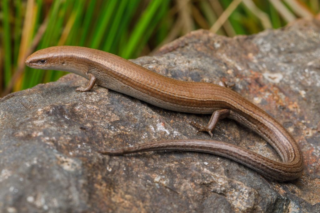
On the Walcha Plateau, the transmission line meets species found almost nowhere else. All records of the long sunskink come from the southern edge of the plateau. In 2022, 23 were recorded at four sites in and around Ngulin Nature Reserve. In 2024, Australian Geographic profiled it as the next animal likely to become extinct in Australia. Targeted surveys on accessible land are not yet complete. The lizard is assumed present across 529.79 hectares on land where owners did not grant access.
The terrestrial crayfish is a short-range endemic species, found only in the highlands of northern NSW at 850 to 1,400 metres. It lives in burrows not connected to streams, so the EIS assumed any clearing on the plateau could affect it, and found it “may be subject to a significant impact”.
The spotted-tailed quoll has become fragmented and isolated. Its numbers are estimated to have fallen by 50 to 90 per cent on the mainland, and by 25 to 50 per cent in NSW, since European settlement. It has been found at 16 locations on the project, and 1,705.22 hectares of its habitat would go.
The yellow loosestrife is known from only four areas in NSW, one of them south of Walcha. It is assumed to grow across 0.93 hectares of the footprint.
The koala turns up along most of the route. Surveys found 51 koalas at 50 locations, from the Hunter to the Nandewars, with the most on the Walcha Plateau (19) and in Bundarra Downs (16).
“The removal of 1,372.61 ha of known and potential habitat is likely to have a significant impact on the koala at the local and state scale,” the assessment report states.
However, local ecologist David Carr is less concerned about the popular Koala than other endangered creatures and ecological communities that will be significantly affected by the REZ.

Other threatened species to be significantly impacted
- Koala: 1,372.61 hectares
- Spotted-tailed quoll: 1,705.22 hectares
- White-throated needletail: 1,452.66 hectares
- Austral toadflax: 1,264.41 hectares
- South-eastern glossy black-cockatoo: 947.07 hectares
- Brown treecreeper (eastern): 752.77 hectares
- Diamond firetail: 656.04 hectares
- Yellow-bellied glider: 565.71 hectares
- Southern greater glider: 539.81 hectares
- Swift parrot: 518.72 hectares
- Hawkweed (Picris evae): 284.02 hectares
- Parma wallaby: 78.74 hectares
“It’s mainly the threatened ecological communities. The three main ones are the New England peppermint, the box gum grassy woodland, and the ribbon gum, mountain gum, snow gum grassy woodland. They’re the ones that are going to be most impacted.”
The transmission line would directly affect 146.75 hectares of the New England Peppermint grassy woodland, a critically endangered ecological community, or CEEC. Of that, 90.96 hectares would be fully cleared. The other 55.79 hectares would be partly cleared: trees and shrubs in the clearance zone come out, and the ground layer stays. This is about 1.05 per cent of the ecological community’s known extent in NSW.
The EIS lists 1,215.62 hectares of White Box – Yellow Box – Blakely’s Red Gum Grassy Woodland and Derived Native Grassland on the transmission line under the NSW listing, much of it grassland. It looks bigger, but it represents 0.00155% of the known extent in NSW. The Ribbon Gum-Mountain Gum-Snow Gum Grassy Forest/Woodland of the New England Tableland Bioregion is the smallest of the three on the route, at 24.38 hectares.
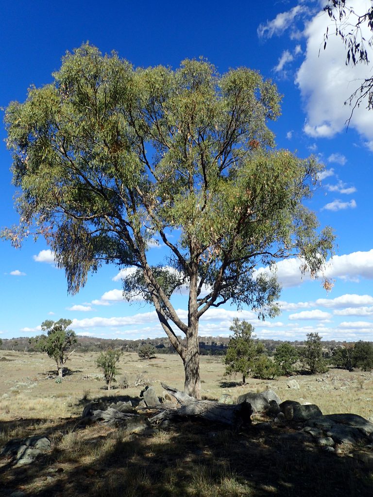
The New England Peppermints in the way of the transmission line
The New England Peppermints have probably been the most talked about environmental impact of this project, led in large part by fifth generation Walcha farmer Daniel Kermode.
“There’s 2,000 of these trees going to be shoved out for the corridor if you go ahead with it,” he said at the NSW Farmers Annual General Conference earlier this year.
He has made similar claims on social media, including in a video with Opposition Leader Kellie Sloane.
While Mr Kermode and Opposition Leader Sloane have been talking about trees, New England Peppermints are not actually protected. The thing the law protects is bigger than that.
“There’s sort of two levels of protection under the Biodiversity Conservation Act,” Mr Carr said. “One is for species, plants or animals, and the other is for threatened ecological communities.”
“It has New England peppermint as the main tree species,” he said. “But what makes it special is the grassy woodland component. The grassy ground layer is made up of tussock grasses and wildflowers, herbs. When you put all those together, you get the ecological community.”
The confusion is common. It is even more confusing when you understand that there are different definitions used at state and federal level. The NSW listing is the New England Peppermint (Eucalyptus nova-anglica) Woodland on Basalts and Sediments in the New England Tableland Bioregion. The Commonwealth listing is the New England Peppermint Grassy Woodland.
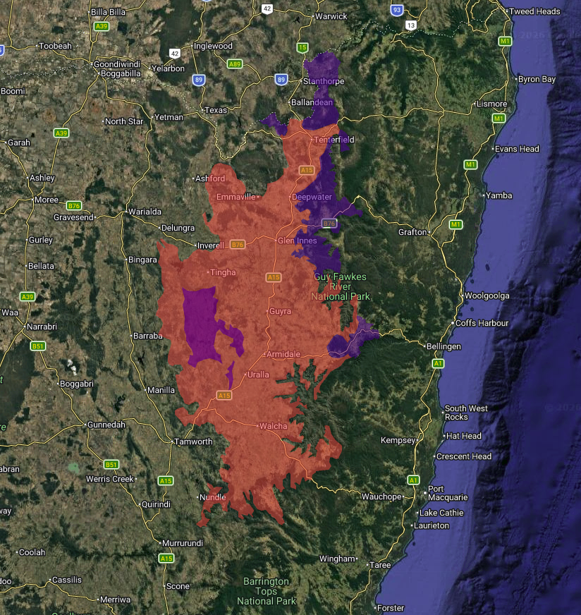
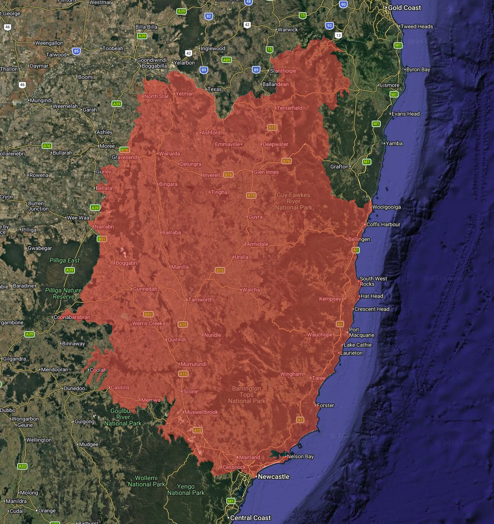
The Commonwealth listing is broader, covering woodlands on clay soils over basalt, sedimentary and volcanic bedrock, and on sandy granite soils, across NSW and Queensland. The NSW listing applies only to woodlands on clay soils over basalt and sedimentary bedrock.
The difference stems from the Commonwealth’s 2011 decision to include all grassy woodlands dominated or co-dominated by New England Peppermint, rather than adopting the more limited NSW classification established in 2003.
“The state and commonwealth legislation uses slightly different definitions, with the latter having a higher condition threshold,” Mr Carr said.
The relevant NSW law is the Biodiversity Conservation Act. The federal law is the Environment Protection and Biodiversity Conservation Act (more commonly just referred to as EPBC). The project must comply with both.
“The EIS has accounted for both the NSW and Commonwealth classifications of New England Peppermint threatened ecological communities,” an EnergyCo spokesperson said.
The price the Peppermints pay
Regardless of the definition, there is less and less of the New England Peppermint woodlands, and what is left is fragile.
“This community is only found on the northern tablelands, from south of Walcha up to Glen Innes, not quite up to Tenterfield, and no further east than Wollomombi, and there’s one outlier population right out near Kaputar National Park. But it’s nearly all on the top of the tablelands above about 900 metres altitude.”
“And what makes it threatened is because mostly we lose the ground layer, and also the trees are very, very susceptible to dieback,” Mr Carr said.
New England Peppermint Grassy Woodland Quick Facts
- Status: critically endangered ecological community under the Biodiversity Conservation Act, listed in 2013
- Where it grows: the New England Tablelands, mostly above about 900 metres
- Estimated total in NSW: 14,000 hectares
- Directly affected by the transmission line: 146.75 hectares (90.96 hectares fully cleared, 55.79 hectares partly cleared)
- Share of known extent: about 1.05 per cent
- Surveyed on the ground: 50.07 hectares
- Assumed from state vegetation mapping, on land not entered: 96.68 hectares
The best estimate is that the total area left of New England Peppermint grassy woodland is about 14,000 hectares. To date, most of the area has been lost due to grazing.
“If you have an intact area, usually what happens is that it’ll be grazed, and grazing animals take out the tastiest plants. So your species diversity just goes down.”
“You’d expect maybe 60 species in the ground layer for something like this. If it’s grazed and continuously grazed, you’ll get down to 10 or 12, half of which are probably exotic species.”
“The grazing then also takes out any new tree regeneration. If you’ve got seedlings coming through of the trees, they get eaten out, and so you just have really big old trees and no younger ones coming through to replace them.”
“New England dieback, which affects trees, particularly the New England peppermint tree, they just get defoliated repeatedly, to the point where the trees die.”
“The project is considered to have a significant impact on the New England peppermint grassy woodland CEEC,” the report states clearly.
The report also states the 146.75 hectares is “considered important to the long-term survival of the CEEC”.
Of the 146.75 hectares, 101.85 is counted as good condition, and almost all of that, 96.68 hectares, is on unsurveyed land where landholders did not grant access. Only 5.17 hectares, or 10 per cent, of the surveyed land was in good condition.
“The other 100 hectares that makes up the rest of that balance is where we haven’t had access, but we’ve just assumed that it’s there and it’s in good condition,” Mr Watson said.
When landholders block access, as some around Walcha have, Mr Watson said EnergyCo follows a process set by NSW DCCEEW.
“Some of that is using aerial. Some of that’s using proxy sites – we might be able to access a roadside or a travelling stock reserve or someone else’s property that’s nearby, and we assess that and can make that kind of comparison.”
“And some of that, is looking over the fence and going, okay, we’re in this area. It’s this type of vegetation. We can see that it’s a good version of that, or a more degraded version of that across from where our corridor is.”
Mr Carr said not having access means that the mapping isn’t great.
“The vegetation mapping and the mapping of threatened ecological communities is really, really inaccurate,” Mr Carr said.
“More likely, they’ll say it’s Stringybark or some common community, and it’s actually New England peppermint, and they won’t because they haven’t been able to get on there,” Mr Carr said.
However, Mr Carr said the goal is always to avoid the better condition areas where they can.
“A lot of the stuff they’re going to go through is going to be in pretty poor condition already,” Mr Carr said. “It’s grazed, it’s flogged out, it’s already not looking good.”
“Hopefully, they’re avoiding some of the better stuff, the better stands of this community.”
“Every hectare is important, but if you’re going to lose anything, you’d want to lose the stuff in really poor condition.”
EnergyCo expects the unsurveyed figures to fall and that its cautious approach “likely overestimates the extent of biodiversity impacts of the project, and additional survey is likely to result in overall predicted biodiversity impacts reducing”.
No matter how much goes, it all hurts.
“It’s just sort of like death by a thousand cuts,” Mr Carr said.
“It’s just a bit more goes, and a bit more goes… It’s not at the same scale as what agriculture is doing to that community at the moment. But it’s all just stacked on top – it just pushes this critically endangered ecological community a bit closer to the brink.”
The law allows it
The transmission line was declared critical state significant infrastructure on Thursday, 27 June 2024.
“State significant developments get a free kick,” Mr Carr said.
“If you were building a house and you had a serious and irreversible impact, that would be the end of your project.”
“Whereas a state significant [project], they just have to acknowledge it.”
Under NSW law, an impact is serious and irreversible if it is “likely to contribute significantly to the risk of a threatened species or ecological community becoming extinct”. The test has four principles: rapid decline, very small population size, very limited geographic distribution, and lack of potential to recover.
For most developments, section 7.16 of the Biodiversity Conservation Act says the consent authority must refuse consent if such an impact is likely. That rule does not apply to state significant development. State significant infrastructure only needs the impacts considered, along with any additional measures to minimise them. There is no requirement to say no.
There are no proposed changes to NSW biodiversity legislation, regulations, or threatened species listings to facilitate the project, and the project must comply with all applicable environmental and biodiversity protections.
The EIS states that “Fifteen SAII entities are known or assumed to occur in the disturbance footprint”. That is two CEECs, three critically endangered species, four endangered species and one endangered population, and five vulnerable species.
Four are confirmed: New England Peppermint grassy woodland, box-gum grassy woodland, the small-fruited mountain gum, and the sooty owl. The other 11 are assumed present, because suitable habitat exists on unsurveyed land. Avoiding these entities “will be further prioritised” as the design is refined.
“That’s part of the requirement under the Act that they have to first avoid impacts as much as possible. Then they have to mitigate those impacts where possible. And then the last option is to offset where they can’t avoid,” Mr Carr said.
Whatever the transmission line cannot avoid must be offset under the Biodiversity Offsets Scheme. The EIS lists a biodiversity credit liability of 687,276 credits, more than half of it on unsurveyed land.
“They’ll identify however many hectares of this community that they’re knocking over,” Mr Carr said. “They’ll score that based on the condition, so that the method they use gives you a score compared to a benchmark for that community.”
“It’s a score out of 100. 100 would be in benchmark condition, and zero would be a car park.”
The full environmental management plan for the project is still to come, but EnergyCo intends to enter a Strategic Offset Delivery Agreement. Under it, the assessment report states, the NSW Department of Climate Change, Energy, the Environment and Water takes responsibility for the offsets, “either through the retirement of like-for-like biodiversity credits or funding conservation actions targeted at species or ecological communities impacted by the project”.
“They’ve got to go and find another site to create a permanent offset,” Mr Carr said.
“This is a permanent conservation area on private land, which is then managed to improve that condition. They get another property with a bit of New England peppermint that’s in poor condition. They manage the weeds. They manage the grazing. They manage the pest, the feral animals. They might do some revegetation to enlarge it, so that you end up with an area that’s in better condition.”
Mr Carr said other communities, such as box-gum grassy woodland, can be offset anywhere in the same subregion or within 100 kilometres of the impact site.
“But New England peppermint just doesn’t grow anywhere else, so they’re going to have to do it all on the tableland.
“They’re going to have to find landholders with decent sized areas of this that they can improve or revegetate.”
The assessment report does not settle whether an offset can truly replace the grassy woodland. On the fourth test, whether the community can recover with management, the report states:
“There is insufficient data available to determine if this EEC is unlikely to respond to management.”
Hard choices
Mr Kermode put the question about his 2,000 New England Peppermint trees that are set to be bulldozed to Environment Minister Penny Sharpe twice. He asked it face to face in Walcha. Then he asked it again from the floor of the NSW Farmers Annual General Conference.
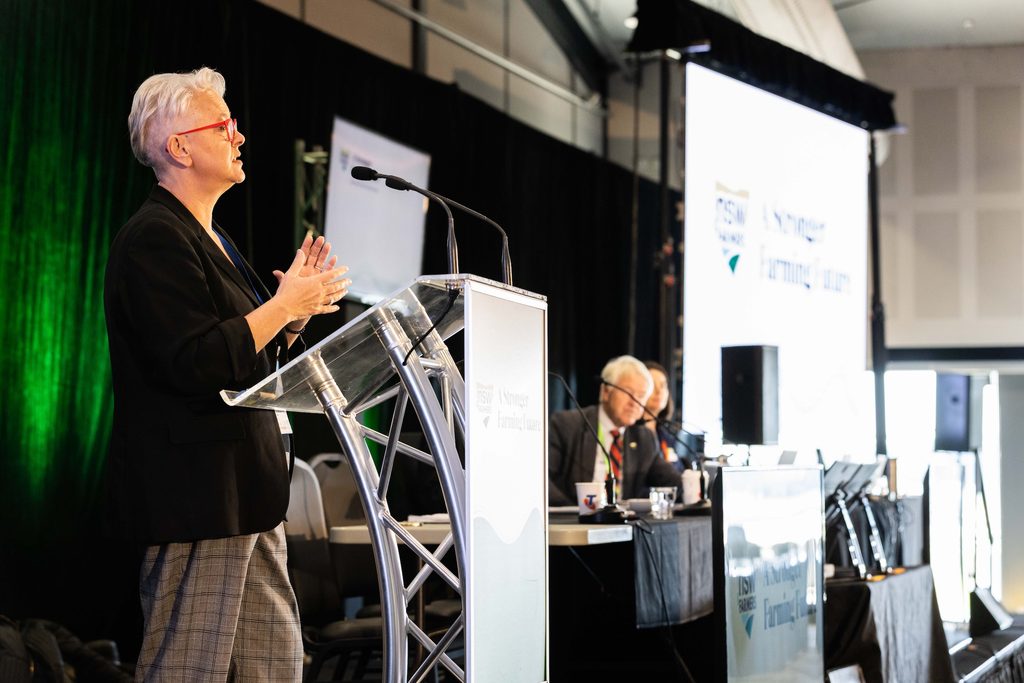
“How can you override a federal government law like that?”
“Well, I’d prefer that we didn’t have to do that,” Minister Sharpe said.
“But when we build any infrastructure, that’s why we have offsetting, and that’s where we try to avoid it as much as we can, and that’s my preference. But where we can’t, then we have to deal with that, and we’ll have to do that through the planning system.”
“Unfortunately, you can’t offset these New England blue peppermint trees because they don’t grow in different soil types,” Mr Kermode said. “They grow in those sodden river flats on Macdonald River.”
“And you need to make that point, and that absolutely needs to be dealt with through the planning process,” Minister Sharpe said.
Mr Carr made a similar point about hard choices, and said the conflict has no easy answer.
“Overriding any of these threats at the moment, clearing or whatever, is climate change. These catastrophic droughts, these storms, anything that’s going to increase with [greater climate variability], is orders of magnitude more significant to these threatened ecological communities than localised impacts,” Mr Carr said.
“The best way to deal with climate change is to move towards renewable energy and get away from fossil fuels. So we need to be supporting that, but at the same time you’re trying to protect what we’ve got left.”
“It’s like a juggling act. How do you manage these competing impacts on these things that have already been smashed by agriculture for 200 years?”
“As an environmentalist and a conservationist, it’s hard to go, yeah, let’s clear some more stuff and get some more windmills. But at the same time, if we don’t do it, more coal, which is going to make things worse.”
Those hard choices are not yet over, with still more tweaks expected through this EIS exhibition period. But they don’t expect the path to change again.
“The way I often describe that is, I don’t see a wholesale change from one valley to another of the corridor itself,” Mr Watson said.
“But the idea of the environmental impact assessment process is that we find out things that we couldn’t have known without doing that consultation.”
Additionally, approval in NSW would not be the end of the questions around environmental damage. The project was determined a controlled action under the federal EPBC Act on 16 March 2026. That means it also needs a separate approval from the Commonwealth Minister for the Environment and Water.
“The Commonwealth’s assessment will consider the likely impacts on matters protected under the EPBC Act, including listed threatened species and ecological communities, and whether those impacts are acceptable,” a National EPA spokesperson said.
Submissions on the EIS close on Thursday, 12 November. The EIS and the Biodiversity Development Assessment Report are on the NSW Planning Portal.
EnergyCo Information Sessions
- Walcha: Tuesday, 27 October, 12pm to 3pm, Walcha Vet Supplies
- Kentucky: Wednesday, 28 October, 3pm to 6pm, Kentucky Memorial Hall
- Gundy: Monday, 2 November, 3pm to 6pm, Gundy Soldiers’ Memorial Hall
- Rouchel: Wednesday, 4 November, 3pm to 6pm, Rouchel School of Arts Hall
- Scone: Thursday, 5 November, 3pm to 6pm, Scone Motor Inn Conference Centre
- Muswellbrook: Friday, 6 November, 11am to 2pm, Muswellbrook Library Seminar Room
- Walcha: Monday, 9 November, 4pm to 6pm, Walcha Central School Hall
- Uralla: Tuesday, 10 November, 3pm to 6pm, Uralla Courthouse
- Armidale: Wednesday, 11 November, 3pm to 6pm, Armidale Town Hall
- Tamworth: Thursday, 12 November, 12pm to 2pm, Tamworth Community Event Centre
- Webinar: “Understanding the EIS”, Tuesday, 20 October, 4pm to 5pm. Register on EnergyCo’s engagement portal. More webinars, including on how the zone will be built and on biodiversity, are planned.
Read our other coverage of the New England REZ Transmission Line EIS
Like what you’re reading? Support New England Times by making a small contribution today and help us keep delivering local news paywall-free. Donate now