

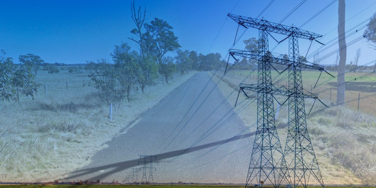
The New England REZ transmission line will put more than 1,000 heavy vehicles a day onto roads built for school buses and stock trucks. The government’s plan for those roads is a desktop study, some widening, and a promise to look harder later.
Glenburnie Road at Kentucky is a gravel road. It runs away from the Kentucky Village on the other side of the New England Highway, past paddocks and a couple of farmhouses, and on a busy day it might see a few utes and a stock truck.
If the transmission project goes ahead as planned, Glenburnie Road will lead to the project’s biggest worker camp and its main energy hub. At the peak of construction, that camp alone is expected to generate about 1,100 vehicle movements a day, around 400 of them heavy vehicles.
The project’s own traffic and transport impact assessment (TTIA) lists Glenburnie Road first among the local roads “most susceptible to construction‑related deterioration.”
Its plan for the road is to seal it and widen it by up to two metres.
The gap between what the REZ will ask of New England’s roads and what is being done to improve them, the lack of timeliness in getting that work done, and the failure to genuinely assess what is required, is raising concerns from even the strongest REZ supporters. New Englanders know how bad our roads are. Our reality is not reflected in the EIS documents.
It is also the clearest example yet of a pattern that runs across the NSW government part of the REZ projects. The region was told the energy transition would leave it better off. The documents now on display indicate the Government intends to do only the bare minimum needed for the project, and not deliver the promised net benefit to New England.
Consultation extended on complex transmission line project
After calls for more time, the NSW Government extended the exhibition of the environmental impact statement (EIS) by two weeks. Submissions on some 16,000 pages of information, taking into account all the additional technical reports, now close at midnight on Thursday, 26 November.
The transmission line is only one part of the REZ, and the roads are being handled in three separate pieces.
The first is the Port to REZ program. Transport for NSW and EnergyCo are working together on state road upgrades so oversize, overmass (OSOM) loads can travel from the Port of Newcastle, with EnergyCo delivering the works. For the New England, loads would skirt Muswellbrook and head north on the New England Highway, bypassing Tamworth’s CBD via Whitehouse Lane, Marsden Park Road, O’Brien’s Lane, and Nundle Road. So far, $68.2 million has been allocated to New England investigations and planning. Upgrades are expected to start in mid-2027, with OSOM movements beginning in 2028 and peaking in 2033.
The second is the transmission project itself, whose traffic assessment sets out the upgrades needed to build the line, hubs, and camps. The third is the wind, solar, and battery projects, which each prepare their own traffic assessment and upgrade the local roads to their sites.
No single document shows what the REZ will do to the region’s roads and transport infrastructure – positive or negative – at once. EnergyCo and Transport for NSW were asked if there is a masterplan for the region, taking into account both renewables and the revival of mining as part of the critical minerals boom. The question was unanswered.
Councils and advocacy organisations are trying to fill the information gap. Uralla Shire Council has launched a newsletter, Our Future, Our Say, a renewable energy page on its website, and quarterly REZ information sessions, starting at the Uralla Courthouse on Thursday, 3 December, at 5.30pm.
The first edition talks up the REZ’s potential for investment, jobs, and infrastructure.
“At the same time, Council acknowledges that residents have genuine concerns about the pace, scale and cumulative impacts of development,” the council wrote.
What the traffic assessment found
The TTIA is Technical Report 7 of the EIS, prepared by engineering firm Aurecon for EnergyCo.
The peak workforce is about 1,400 people, about 1,250 of them living in five camps. As discussed in our earlier coverage, those camps are temporary housing on EnergyCo land, not new housing in existing townships as originally promised.
At peak construction, expected in late 2030, the project is forecast to generate about 3,668 vehicle movements a day, including about 1,100 heavy vehicles. On top of that come 53 “high-risk” OSOM movements, the biggest weighing up to 250 tonnes before the trailer is counted.
Nearby wind and solar farms could add up to about 2,800 more vehicle movements a day during peak overlap periods.
The TTIA finds the network has the capacity to cope. It says upgrades are needed instead “to improve safety, accommodate increased heavy vehicle movements, and provide adequate road width and geometric standard.”
About 57 intersections need work, most through permanent upgrades such as turning lanes. The schedule of road upgrades lists 29 roads, and each gets a version of the same treatment. Fifteen get “localised widening up to 2 metres.” Ten get localised widening and sealed widening up to two metres. Four, Boorolong, Glenburnie, Inglewood, and Romani roads, get “full length sealed widening up to 2 metres.”
A number of these roads, like Glenburnie Road, are currently unable to cope with two trucks passing without both vehicles putting their left wheels off the roadway.
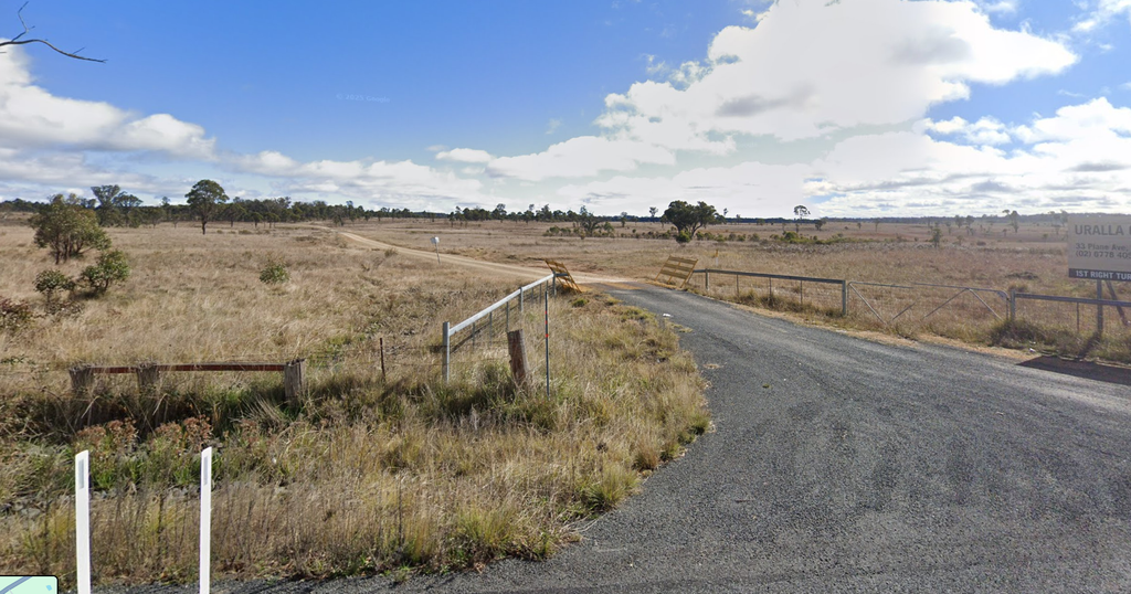
Road condition gets far less attention. The TTIA describes its assessment of existing conditions as “driving the route, undertaking desktop and mapping analysis” to “qualitatively assess” construction routes. Its crash data comes from public Transport for NSW records for 2020 to 2024.
The TTIA does name the roads most at risk: Glenburnie, Barry, Waverley, Scrubby Gully, Niangala, Ruby Hills, Wollun, and Sargeants Gap roads, and Forest Way. It warns of “accelerated degradation of unsealed surfaces, including rutting, corrugation and loss of material” and “increased potholing and reduced pavement integrity following wet weather.”
Forest Way and Wollun Road are on that list, but neither appears in the schedule of upgrades. EnergyCo says any sealing will be considered case by case, in consultation with councils and road authorities.
Sargeants Gap Road sits over karst geology linked to the Timor Caves system. The TTIA says it “may include targeted geotechnical investigation.”
For the rest, the TTIA promises surveys before construction, repairs during it, and reinstatement afterwards “to a condition consistent with pre-construction levels, unless otherwise agreed.”
In other words, the roads are to be handed back as they were found. Not better.
EnergyCo says the TTIA was never meant to be the final word.
“The Traffic and Transport Impact Assessment (TTIA) is a high-level assessment of potential construction routes, impacts and road upgrades for the REZ,” an EnergyCo spokesperson said.
“It is informed by field inspections (driving multiple routes, site visits where further information was needed including physical inspections of sections of roads) and consultation with councils and Transport for NSW.
“More detailed investigations, including geotechnical testing, will be undertaken by the Network Operator during detailed design, consistent with the approach taken for Central-West Orana REZ.”
“We encourage any further information on crashes or conditions to be submitted through the EIS process,” the spokesperson said.
Kentucky: the quietest corner of New England to become the busiest corner of the REZ
Nowhere carries more of the load than the country around Kentucky, south-west of Uralla.
Central Hub A, the substation at the heart of the network, sits about eight kilometres west of the village on Glenburnie Road. Camp 5, the project’s biggest worker camp, sits beside it.
The TTIA calls Camp 5 “the primary construction node.” It will serve four energy hubs and generate about 1,104 vehicle movements a day at peak, including 404 heavy vehicles, more than double any other camp.
Almost all of it would use Glenburnie Road and the New England Highway between Glenburnie Road and Uralla, which the TTIA calls “the most heavily utilised construction corridor across the project.” In the morning peak, about 200 construction vehicles are expected to head north on a section that now carries about 60 northbound vehicles at that time.
Along the corridor from Glenburnie Road to Armidale, the TTIA found 30 reported casualty crashes in five years: one fatal, 13 with serious injuries, and 16 with moderate injuries.
That crash data only counts crashes where someone was hurt. In its review of the corridor from Glenburnie Road to Armidale, the TTIA notes “no non-injury crashes are represented in the dataset.” In the New England, where many crashes on local roads never make it into state records – and the hospital is too far away and too understaffed to be bothered for minor injuries – that leaves a lot out.
Nearby Kentucky Road, which links the New England Highway to Wollun, shows how tight the margins already are. It is approved for B-doubles, but with time-of-day restrictions between 7.30am and 9.30am and 2.30pm and 4.30pm on school days, so that school buses are not endangered by having to compete with B-Doubles on a road that is too small for both of them.
Kentucky sits in Uralla Shire, and the shire’s road network was already stretched before the REZ arrived.
Uralla Shire Council’s transport asset management plan, last revised in 2017, covers about 933 kilometres of roads, more than half of them unsealed.
“One of the major issues facing the Uralla Council is the provision of adequate funding for roads maintenance, renewals and upgrades to cope with increased traffic volume, population and higher community expectations,” the plan states.
It put the shortfall in road funding at about $480,000 a year.
“Council’s present funding levels are not sufficient to continue to provide existing services at current levels in the medium term,” the plan states.
Its 2015 data showed about 34 per cent of the shire’s unsealed roads had less than a quarter of their gravel life left.
The plan’s busiest rural local roads carry more than 75 vehicles a day. The traffic out of Camp 5 alone would be more than 14 times that, most of it on Glenburnie Road.
The plan also records what it took to win a few kilometres of seal around Kentucky. Residents “lobbied strongly for the sealing of the final four kilometres of Bergen Road.” The work was finished in April 2016.
The engineer’s view
Joshua Devitt is Chief Engineer at IPWEA NSW, the professional body for public works engineers who build and maintain council roads. He said REZ road upgrades so far had focused on getting OSOM trucks through.
What is an OSOM?
OSOM stands for oversize, overmass. It is any truck that, with its load, is too big or too heavy for normal road rules. That usually means it is carrying one large item that cannot be broken down into smaller loads, like a transformer or a wind turbine blade
OSOM vehicles can only travel on approved routes, often need permits, and usually move slowly with escort vehicles.
For the REZ, the biggest OSOM loads are the transformers for the energy hubs. Each weighs up to 250 tonnes, about six times the limit for a fully loaded B-double. The truck carrying one is about 74 metres long, the length of four B-doubles end to end.
“What the above does not cover is a focus on the condition of the road surface or pavement and the potential impacts of these by construction equipment,” Mr Devitt said.
“EnergyCo and Transport for NSW will argue that the local roads are the responsibility of council to manage, and that, provided the OSOM movements do not exceed axle loadings, there shouldn’t be any material impact to the road or pavement.
“I’m of the opinion that this doesn’t really hold up in light of some of the traffic volumes being discussed, and ties into the concerns of many regional residents and Council staff who are frustrated is seeing all of the money being poured into the REZs without any substantial benefit being realised by their affected communities.”
Widening, he said, only works if the original pavement was built for the load and the new shoulder is built properly.
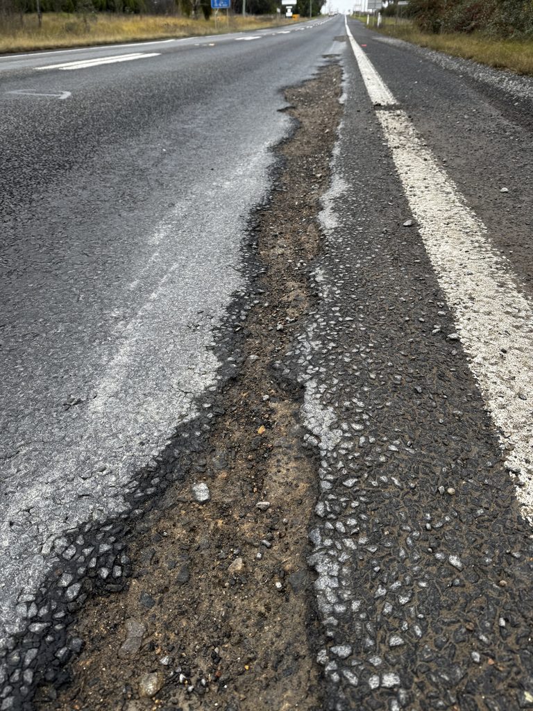
“However, my experience has been that typically one or both of these factors are not present, and roads which have been widened start to fail either along the joint of the old and new pavement, or in the centre of the road where the pavement isn’t able to cope with the increased vehicle loads,” Mr Devitt said.
Anyone who has driven a patched country road knows the result: a smooth new edge, and a broken, ridged centre where the old road gave way.
“The seal (the black stuff on top) generally fails due to poor maintenance, the pavement (the stuff underneath) fails either due to water ingress from seal failure, or from overloading due to too much / too heavy loads,” Mr Devitt said.
The roads were already behind before the REZ was conceived. The rapid disintegration of the New England Highway when the Pacific Highway traffic was diverted last year should have sounded some alarm bells that even the national highway’s maintenance was so poor that it could not withstand the forecast heavy traffic, let alone the badly neglected regional roads.
“Suffice to say that we have long term data that shows that maintenance of the NSW local road network is underfunded to the tune of $164M per year,” Mr Devitt said.
“Our data stretches back over 20 years, which resulted in a cumulative underspend of $3.3B in today’s dollars.”
IPWEA NSW and ACT’s 2025 Road Management Report found more than $5 billion of council road and bridge assets are in poor to very poor condition, function, or capacity. About 13 per cent of council-managed unsealed roads, worth $956 million to replace, are in poor to very poor condition.
“Functional performance, particularly of unsealed roads, is stagnating or declining,” the report states.
Mr Devitt said the state program for rest stops and overtaking lanes was underfunded and running late. He said IPWEA’s Asset AI tool could assess the condition of affected roads before construction, and “would be more detailed than what sounds like the desktop study that Transport have used.”
The missing links
The route between Uralla and Walcha shows how much depends on other projects.
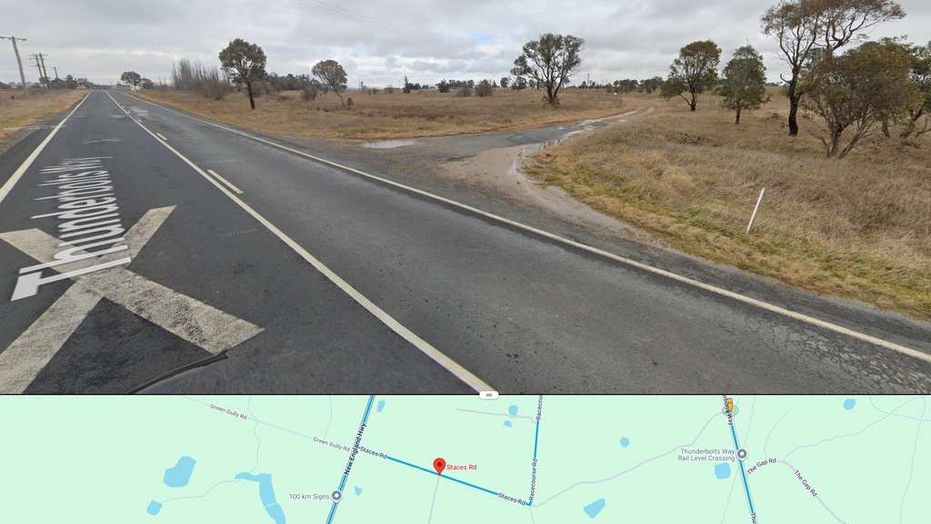
Transformers for the Central South hub near Walcha Road would travel a 58-kilometre OSOM route via Staces Road, Thunderbolts Way, and the Oxley Highway. The TTIA’s own summary table says parts of that route are “not approved routes” on the NSW OSOM network. EnergyCo says Thunderbolts Way between Uralla and Walcha is approved under multi-state Class 1 exemption notices.
The route also relies on a new road linking Staces Road and Thunderbolts Way, so OSOM loads can avoid Uralla township. The TTIA says that link is to be built “by others,” timed with the start of the Winterbourne Wind Farm in 2027. EnergyCo says the NSw Government is planning the extension as part of Port to REZ, subject to further assessment and consultation.
Rail is the other road not taken.
The Main North line already runs through the heart of the REZ. The line remains functional as far as Dumaresq, just north of Armidale. It is still being invested in, with Transport for NSW’s Rail Infrastructure Upgrades project carrying out works at stations and on the line up to Armidale.
That is almost exactly the footprint of the transmission project. The REZ construction area barely extends beyond the line’s working end.
The TTIA gives rail just two paragraphs. It says rail for OSOM components “has been considered at a high level,” and cites bridge and tunnel clearances and axle load limits, without figures or locations.
It acknowledges “rail terminals and intermodal facilities exist within the broader region, including at Tamworth and in proximity to Armidale,” but says “temporary last-mile transfer points from rail to road would still be unavoidable for most destinations.”
For everything else, it offers one sentence: most tower components and materials “can be readily accommodated on articulated vehicles and B-doubles.” There is no assessment of the pros and cons of moving bulk materials by train to a railhead near Uralla or Walcha Road, then trucking them the last few kilometres.
When asked about the failure to properly consider rail, EnergyCo repeated that rail would not remove the need for road transport to construction sites. Given multiple opportunities, the agency repeatedly failed to acknowledge there may be benefits in getting that much traffic off the already strained New England Highway that should, at a bare minimum, have been considered.
The TTIA’s cumulative assessment also leaves significant gaps in that it does not consider other industries. For example, it does not mention the construction traffic for the Taronga mine at Emmaville, or the potential for other mines that may be revived as part of the critical minerals boom. There appears to be no allowance for peak agricultural traffic, such as around harvest, or spring and autumn peak livestock trading.
What is left for the roads
Trucks will use these roads for EnergyCo purposes for six years. The upgrades are designed to get them through, not to leave the region with a better network. That leaves councils, which own most of the local roads in question, carrying the risk, and the ongoing maintenance, with no known ongoing boost to funding to do so.
“The business case for the Muswellbrook to Armidale Corridor commenced in February 2026 and is currently being finalised,” a Transport for NSW spokesperson said.
It also covers the highway, not the local roads the TTIA flags as most at risk. On those, Transport for NSW offered monitoring.
“Transport for NSW will continue to monitor the performance of the network to help enable the safe and efficient movement of all road users, including OSOM vehicles while providing all road users with information for planning their journey,” the spokesperson said.
Mr Devitt said councils could negotiate with REZ developers to fund upgrades on affected roads, as some do with mines, and some already have. But this could be made easier.
“There is also more of a role that EnergyCo, Transport and DPHI could be playing in facilitating these types of arrangements,” he said.
Submissions on the REX network infrastructure EIS close at midnight on Thursday, 26 November, through the NSW Planning Portal. It is the last formal chance for New England to put its roads on the record before the trucks arrive.
“Community input is a vital part of the planning process and I encourage everyone with an interest in the project to take the opportunity to make a submission before Midnight, 26 November 2026,” said Minister for Planning and Public Spaces Paul Scully.
Read our other coverage of the New England REZ Transmission Line EIS
Like what you’re reading? Support New England Times by making a small contribution today and help us keep delivering local news paywall-free. Donate now